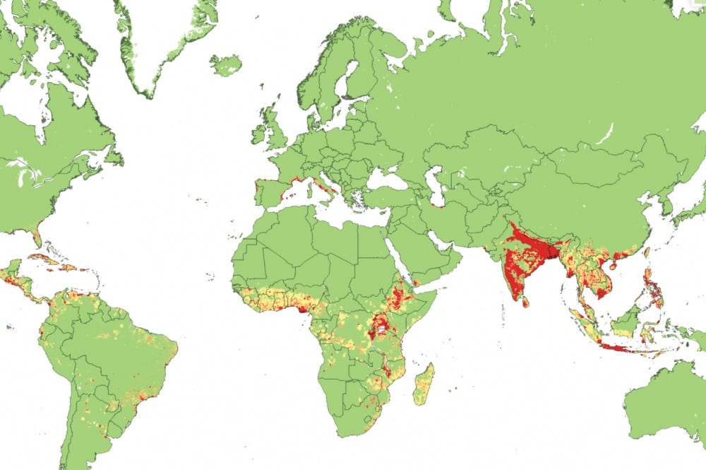
A new computer application — called CHIKRisk — uses statistical modeling to help predict the risk of an outbreak of the chikungunya virus, a disease transmitted by mosquitoes, which produces symptoms that include fever, rash, and severe joint pain. The Defense Threat Reduction Agency (DTRA) collaborated with the Universities Space Research Association (USRA) to develop the application that maps and monitors the risk of acquiring the virus anywhere in the world. The Armed Forces Health Surveillance Center’s Global Emerging Infections Surveillance (GEIS) is using CHIKRisk to inform warfighters and decision-makers on the areas where future outbreaks of the chikungunya virus may occur. The application took three years to develop, and in the final year, 2019, a team of Netflix film crew members accompanied USRA’s principal investigator to South Africa to film some of the underlying fieldwork that went into developing the application. The Netflix documentary series, Connected, will air in the fall of 2020.
U.S. warfighters stationed in the Americas, Africa, Asia, and Pacific regions must protect themselves from the threat of the chikungunya virus. A person who has acquired the chikungunya virus is infectious in the first week of illness, which means that the infected person can transmit the virus to another person through a mosquito bite: a mosquito bites a person with the virus and then bites another person, giving the second person the virus. There is no medical countermeasure for the chikungunya virus, so warfighters must rely on mosquito repellents, including clothing and bed nets, to prevent mosquito bites. Aiding in the prevention effort is CHIKRisk, which informs warfighters when and where to use mosquito repellents.
CHIKRisk is dynamic and automated; it uses real-time data, so scientists at GEIS can quickly and easily publish the risk of chikungunya outbreaks based on the statistical modeling. The application integrates outbreak data, climate data, satellite data, climate anomalies, and mosquito vector data, historical (some data go as far back in time as 1948) and present, to produce current and forecasted risk maps. The application can visually depict global historical outbreaks and risk maps by month, or year, and predict the risk of acquiring the disease based on many variables: rainfall, land-surface temperature, near-surface temperature, specific humidity, soil moisture, vegetation index, rainfall and temperature forecasts, elevation, and population.
Scientists who developed the application gathered data from various sources. The Program for Monitoring Emerging Diseases, Pan American Health Organization, and the Armed Forces Health Surveillance Branch provided global, historical data on chikungunya virus outbreaks. The Walter Reed Biosystematics Unit and the National Institute of Allergy and Infectious Diseases provided data on the activity of Aedes aegypti and Aedes albopictus, which are mosquitos responsible for the chikungunya virus. The National Oceanic and Atmospheric Administration’s Climate Prediction Center provided current and forecasted climate data.
DTRA’s CHIKRisk is continuously validated against near-real-time outbreak data and has been operationalized to support warfighters deployed around the world. CHIKRisk provides warfighters advanced warning on areas where the risk of exposure to the chikungunya virus is higher, which enables warfighters to increase their preventive, protective posture to ensure that they remain mission-ready. The new application can also alert global allies of the potential of an outbreak of the chikungunya virus in their countries.


